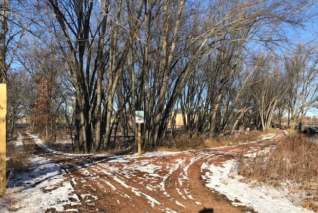
Thinning cut along Moses Creek Trail

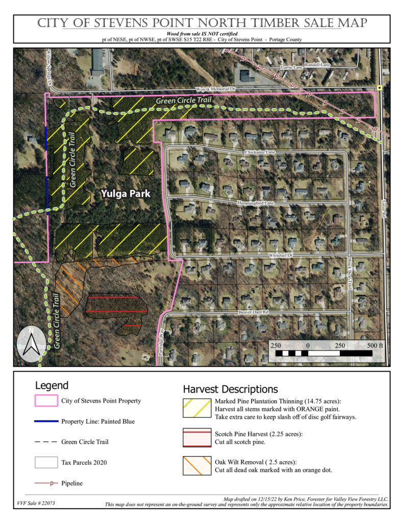
The City of Stevens Point has contracted with Weekly Timber to conduct a thinning cut on City-owned lands around the Yulga Disc Golf Course. The thinning will take place on an aging red pine plantation with the goal of improving the overall health of the forest. The work will begin on Friday, December 6 and take approximately 3 weeks. The Moses Creek segment of the Green Circle Trail that runs through this area will remain open as much as possible, but please obey all signs in case of a temporary closure. See the map below for more information.

If you have any questions, please contact the Stevens Point Parks, Recreation, & Forestry Department at 715-346-1531.

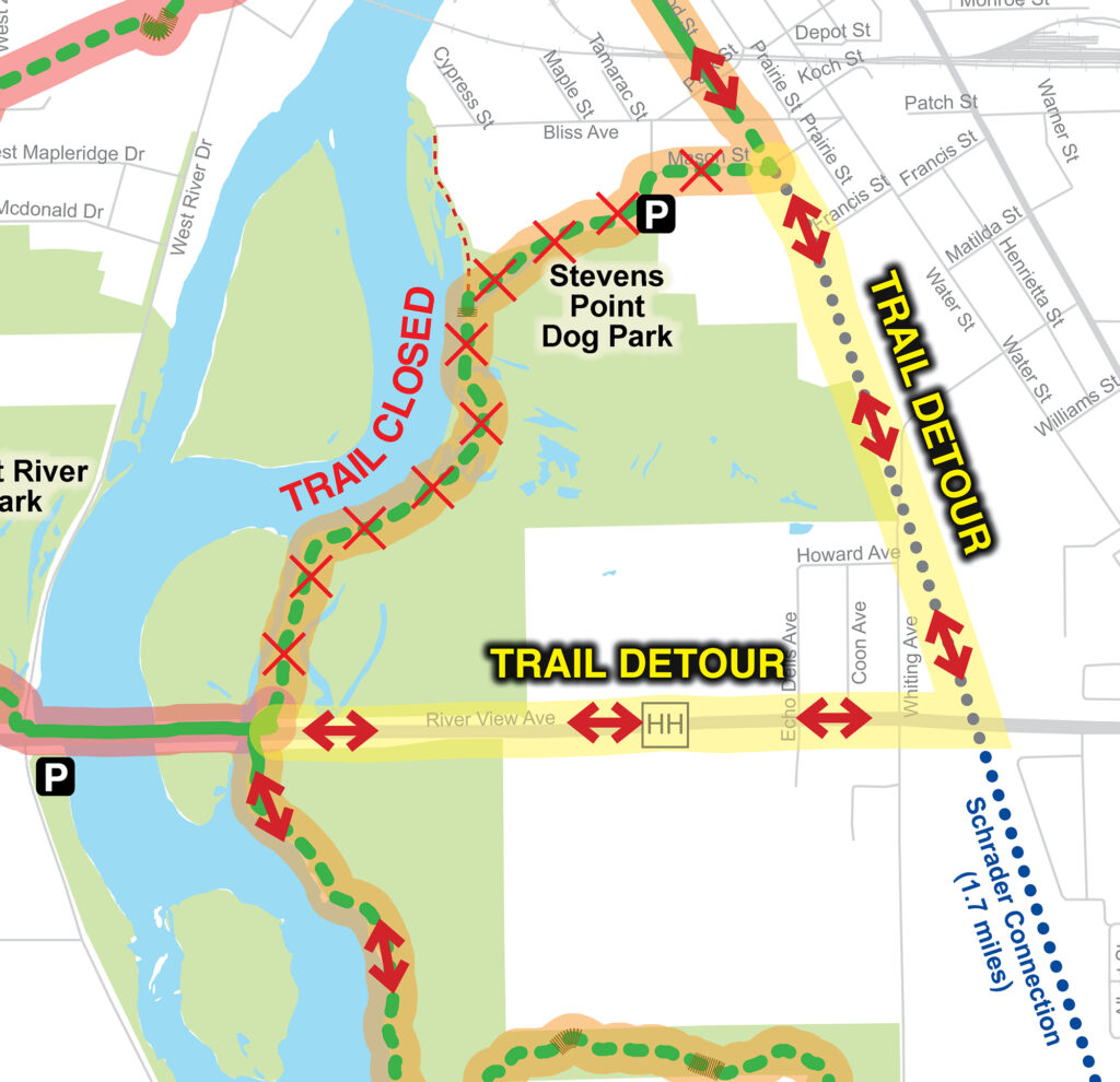
River Pines Trail detour

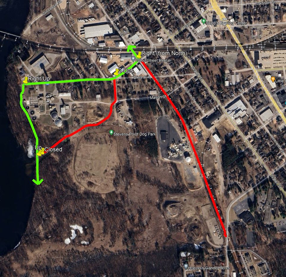
The north end of the River Pines Trail segment near the Stevens Point water treatment plant is detoured during the summer 2024 for a city road construction project. The detour follows the original trail route past the Stevens Point Water and Sewage Treatment offices using Bliss Avenue, Park Street, and Wood Street. The map below shows the detour (green) and closed portions (red). Please follow the detour signs.

Airport Reroute

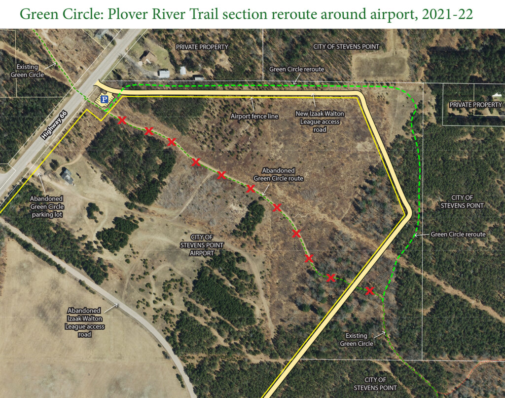
Starting on May 4, crews will be working on constructing a new route for the Plover River Trail around the Stevens Point Airport. The old trail will remain open until the new one is completed, likely during the week of May 16. Please use extra caution out on the trail and yield to any construction equipment. Click the image below for more details.

North end of River Pines Trail rerouted

The north end of the River Pines Trail has been rerouted off a city street near the Stevens Point wastewater treatment plant. With the help of the Stevens Point Water Department and the Parks, Recreation, and Forestry Department, the reroute travels through the woods and around the Stevens Point Dog Park to the Schrader Connection. This “green” enhancement eliminates a 0.4 mile segment of trail that followed roads.

Whiting Crossing Reroute

The Whiting Crossing Trail reroute is now open! The 2.1-mile section provides a greener, more aesthetic experience for users. It travels through Mainland Meadows (part of the Whiting Well Field) and Upper Whiting Park (along the Plover River), connected by a short on-road segment along Elm Street. A rapid flashing beacon assists bicyclists and pedestrians to cross the busy Post Road/Business 51. Click the map below for more details!

Bridge Decking Replacements

During the week of October 7-11, a WisCorps crew will be replacing the wood decking on two bridges along the Green Circle. The first bridge is located on the Paper Mill Trail over the Plover River. The second bridge is on the River Pines Trail near the wastewater treatment plant. These sections of trail will be closed while the decking is being replaced… likely 1-2 days for each. Click here to see location and detour maps.

Moses Creek Trail detour

The Moses Creek Trail is now reopened. The boardwalks have been surfaced with a slip-resistant paint for the safety of walkers and bikers. Please let us know how it works! As always, slow down and use caution on any boardwalk surface, especially in wet conditions or when they are covered in leaves or pine needles.

What’s New Walk

Join us on Saturday, April 20, to be one of the first to walk on the newly rerouted Paper Mill Trail in the Village of Whiting. The trail runs along the Wisconsin River through the former Whiting paper mill land.

The event will kick-off with a brief program near the Stevens Point Brewery, before heading out on the 4-mile out-and-back route.

All are welcome. The event is free and open to the public. More information at https://www.facebook.com/events/311046516248071/