-
Length:
3.8 miles
-
Surface:
Crushed granite trail and boardwalk
-
Activities:
Hiking, jogging, biking, pets, cross-country skiing
-
Parking:
Lot off of Hwy. 66 (north), end of Hofmeister Dr. (south)

Features
A Travel Corridor
The Plover River has always been an important transportation route in this region. Menominee and other Indian tribes canoed the waterway to reach hunting grounds or to visit other villages. French voyageurs traveled the river in the 1700s to trade with the Indians for furs trapped on the river’s backwaters. In time, treaties opened up the land to lumberjacks, who floated white pine down to the Wisconsin River. Today, this stretch of river is a popular recreational canoeing and kayaking route.
“The Wells”
The protected lands along the Plover River feed the well fields for the City of Stevens Point. The trail cuts through an area popularly known as “the wells.” The Izaak Walton League, one of the oldest conservation organizations in Wisconsin, purchased 147 acres of land here. Through the League, the well fields became a protected watershed for the Plover River.
Groomed Ski Trails
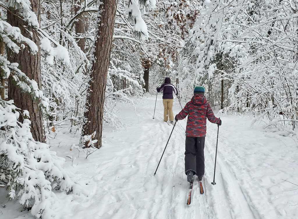 In winter, the Plover River Trail connects with other trails to offer three cross-country ski loops groomed for classic (stride) skiing, for a total of 4.1 miles. Use of the ski trails is free. The trails are mostly flat with a few steep hills. Click here to view a map of the ski trails. Pets, hiking, snowshoeing, and biking are not allowed on the groomed trails. Contact Portage County Parks at 715-346-1433 for current ski trail conditions.
Birding Information (Site #3)
The Plover River Trail of the Green Circle can be accessed from Hwy. 66 (north of the airport) or on Maria Drive just east of Barbara’s Lane. This is the only segment of the Green Circle Trail that is regularly groomed for skiing.
If one starts at Hwy. 66, you are exposed to a predominantly open area that then threads through a red pine plantation. Over 30 nest boxes are located along the trail on the east side of the airport along the trail and are monitored by ALAS members. These boxes are designed for bluebirds, but Tree Swallows, wrens, and chickadees nest in them as well. Other birds which occur in this habitat are Chipping, Field, and Vesper Sparrows (spring/summer) and juncos (winter). Watch for a Red-tailed Hawk circling in this open area.
In about 0.25 mile, one enters a mixed deciduous forest which continues east to a loop entering from the
north. Take the trail to the south. It is possible to stay on the upland loop or drop down into the Plover River valley. Along this section is a high concentration of jack pines, where towhees, cardinals, and woodpeckers (Downy, Hairy, Red-bellied, and an occasional Pileated) may be found.
Soon the trail parallels the edge of Izaak Walton League (Bill Cook Chapter) property and skirts the east side of the airport. In winter, Snow Buntings may be seen here occasionally and Horned Larks are common nesters. In about a mile one comes to an extensive area of oak wilt that involved removal of hundreds of trees. At the end of this section one comes to the north side of the Cit y of Stevens Point well field (Well #10).
The trail curves to the south around the well field/shooting range area with the Plover River on the east.
This is one of the most scenic areas along the trail. In fresh snow, look for tracks of rabbits, squirrels, weasel, fox, fisher, and otter (also look for otter slides on the river bank). Beaver stumps can also be seen here along the river. Birds that frequent this area in spring and summer are Red-shouldered Hawk, Barred and Great-horned Owls, and Sandhill Cranes. At this time of year, watch for skunk cabbage and marsh marigolds in the river bottom. The trail leaves the river bottom after about a half mile and passes through a mature hardwood forest.
The parking area at the east end of Maria Drive is a great birding area in April and May at the height of migration. The connecting trail accesses the wooded Green Circle as it continues to follow the Plover River south to Interstate 39. A cornucopia of warblers, vireos, and other songbirds may be seen during this time.
Skiing the trail takes 1-2 hours, depending on the number of loops taken. Snowshoeing and hiking takes 2-3 hours.
Photo Gallery


